Chu Lai
Chu Lai
A coastal locality in Quảng Nam province, Chu Lai blends the military heritage of the Vietnam War, quiet beaches and access to the volcanic island of Lý Sơn.
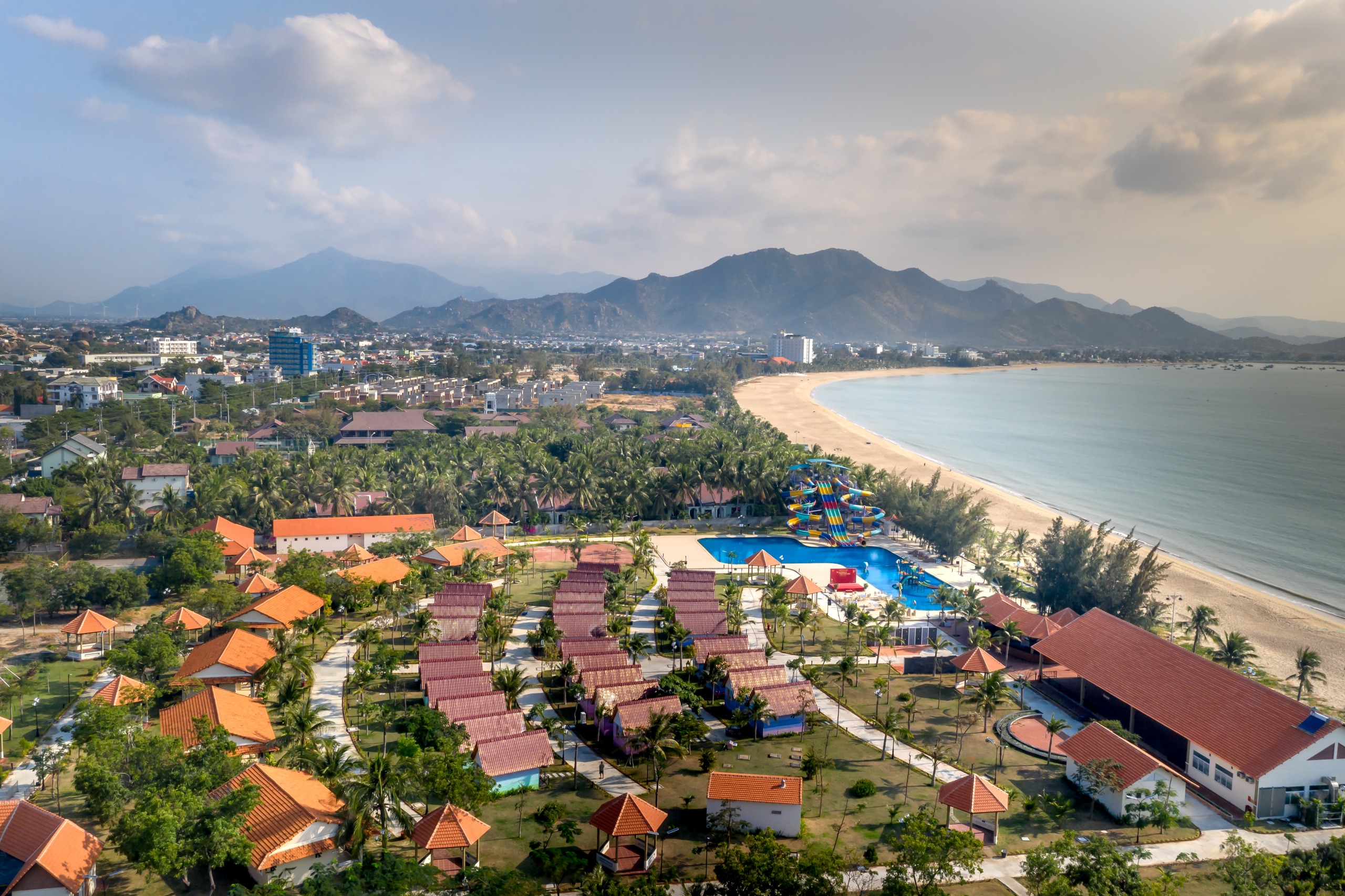
Chu Lai is a coastal locality in Núi Thành district, in Quảng Nam province, central Vietnam. A former American Marine airbase during the Vietnam War, the site today combines visible military heritage, an active civil airport and a relatively undeveloped shoreline that serves as a gateway to the volcanic island of Lý Sơn.
Why visit Chu Lai
- A major historical site of the Vietnam War, where Operation Starlight took place in 1965.
- A coastline still largely untouched by mass tourism, with beaches and rock formations.
- A convenient gateway to Lý Sơn island and the neighbouring Quảng Ngãi province.
- An operational airport that simplifies access from Hanoi or Ho Chi Minh City.
History
Chu Lai's modern history is inseparable from the Vietnam War. Between 1965 and 1971, the area housed an advanced airbase for the United States Marines, created to relieve military traffic that had saturated Đà Nẵng airport. The aerodrome became operational on June 1, 1965 and played a central logistical role in operations conducted across central Vietnam.
The place name itself harkens back to this era: General Victor Krulak, then commander of Pacific amphibious forces, transposed his own name in Chinese transcription to designate the zone, and the usage has persisted.
A few weeks after the base became operational, the region became the theatre of Operation Starlight, considered the first major land offensive conducted by the Marines in Vietnam against Viet Cong forces. After the American withdrawal, the site returned to Vietnamese civilian and military use, and today hosts Chu Lai airport, open to commercial traffic.
What to see and do
The shoreline and Rang Beach
The Núi Thành coast alternates between stretches of pale sand and rocky outcrops. Rang Beach remains one of the most accessible from Chu Lai and retains moderate foot traffic, largely local. It's a good spot for swimming during the dry season and for observing fishing life in the morning.
Coastal rock formations
The area features several dark rock formations along the shoreline, sculpted by erosion. These black boulders, sometimes aligned for several hundred metres, provide a striking contrast with the sand and make for appealing photography, especially toward evening.
Remnants of the American base
A few military infrastructures from that era remain around the current airport. They are not the subject of organized museography, but their presence helps convey the scale of the American presence in the region.
Hoàng Sa activists' loyalty ceremony
On the 15th and 16th days of the lunar calendar, the region maintains a tradition made famous on neighbouring Lý Sơn island: the loyalty ceremony of Hoàng Sa activists. It pays tribute to the sailors dispatched under the Nguyễn dynasty to assert Vietnamese sovereignty over the Hoàng Sa (Paracel) and Trường Sa (Spratly) archipelagos. If your visit coincides with these dates, you'll have the chance to witness a living ritual connected to central Vietnam's maritime identity.
When to go
The most favourable period spans January to March: temperatures between 22 and 25°C, low rainfall and generally calm seas. Broadly speaking, the dry season runs from December to April. From September onwards, the region enters a period of sometimes heavy rains, best avoided for beach activities.
How to get there
Two main options:
- By air: Chu Lai airport is served by domestic flights from Hanoi and Ho Chi Minh City. This is the quickest option and most practical if you plan to continue to Quảng Ngãi or Lý Sơn.
- By road: from Đà Nẵng, expect about 150 km heading south on national highway QL1A, passing through Tam Kỳ. The journey takes 2.5 to 3 hours depending on traffic, by private car or regional bus.
Practical information
- Location: Núi Thành district, south of Quảng Nam province.
- Distance to Tam Kỳ: 34 km, approximately 50 minutes' drive.
- Distance to Quảng Ngãi city centre: 42 km, approximately 1 hour's drive.
- Local transport: taxis and shuttles available from the airport; a car with driver remains the most flexible option for exploring.
- Accommodation: limited supply on site, more extensive in Tam Kỳ and Quảng Ngãi.
To see in the area
- Lý Sơn island (Quảng Ngãi province): a volcanic island accessible by ferry from Sa Kỳ port. You can visit Thới Lời mountain, Hang and Đục pagodas, the natural gateway Tò Vò and the islets Bé and Lớn.
- Tam Kỳ: provincial capital of Quảng Nam, 34 km to the north.
- Hội An and Đà Nẵng: approximately 150 km away, easily combined with Chu Lai in a central Vietnam itinerary.
To plan a wider tour, also consult our guide to Cát Bà and biosphere preservation to the north, or southern sites such as Cai Rang floating market and Bà Den mountain.
Frequently asked questions
Frequently asked questions
Chu Lai is mainly justified by its historical interest tied to the Vietnam War and as a gateway to Lý Sơn island. For a purely beach-focused stay, the beaches of An Bàng near Hội An remain more accessible.
You must travel to Sa Kỳ port in Quảng Ngãi province, approximately 1.5 hours' drive to the south. Fast ferries operate the crossing to Lý Sơn in less than an hour, weather permitting.
January to March for dry and temperate weather (22-25°C). The broader dry season runs from December to April. Avoid September-November, which are subject to heavy rains and typhoons.
Yes, the airport welcomes regular domestic flights from Hanoi and Ho Chi Minh City. It primarily serves southern Quảng Nam and northern Quảng Ngãi.
Prepare your trip
Chu Lai fits well into a central Vietnam itinerary combining Đà Nẵng, Hội An, My Son and Lý Sơn. To build a custom programme, explore our Vietnam travel ideas.
Interested in this visit?
We can include it in your personalised itinerary.